Cuo Viet is the name of both a river, a river region, and a base camp just north of the river. Just below the DMZ, and north of the mouth of the Cua Viet River, the C-4 base camp is here seen in respect to the surrounding terrain.
This aerial photo shows the corner of Camp Kistler from a chopper during a rocket attack, with a hit to the fuel dump. A ship can be seen attempting a back-away. The perspective is looking down the mouth of the river toward My Loc. Camp Kistler was the basecamp for the 1st Amphibian Tractor (Amtrac) Battalion of the 3rd Marine Division.
This series of photos show C-4 bunkers constructed of 12" x 12" lumber and covered with tons of sand. As Richard describes it, "...it was one of, if not the first of the "McNamara Positions"....His "vision" was to build a series of interlocking firebases across the southers edge of the DMZ like a Maginot Line to stop infiltration."
Here is an aerial photo of Tan Son Nhut, black and white, fairly large but very detailed.
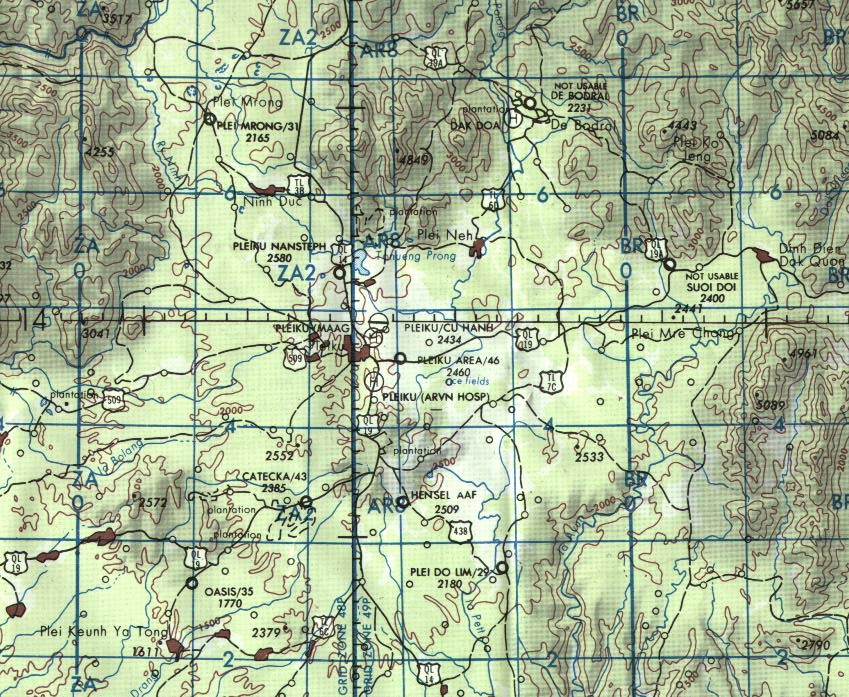
Detail area of PLEIKU (209K)
Detail area of CU CHI (121K)
Detail area of TAY NINH (220K)
Area around Binh Son, Blackhorse, Xuan Loc, Gia Ray (165K)
Area around Vung Tau, Long Dien, Dat Do, Binh Ba, Binh Gia (198K)
Area around Tan An, My Tho, Go Cong (319K)
Up Thunder Road to Lai Khe (187K)