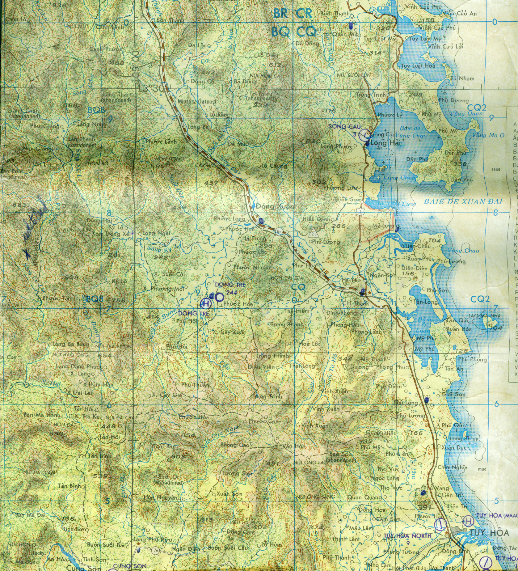
I was an aerial observer in L-19s and H-13s in Vietnam from Oct 66 - Sep 67. I flew a total of 104 missions out of Tuy Hoa (north & south fields), Song Cau, and Qui Nhon. I still have my folded 1:250,000 Joint Ops Graphic sections dated 1965 covering the coast from Nha Trang north to the Phu Cat airstrip a few miles northwest of Qui Nhon.
On these maps you will see some hand written notations. Our maps at the time did not always reflect reality ... as on
Map 00 and
Map 02 where the red pencil line that I had to draw in myself indicates the true route of Highway 1 along the coast. Later maps corrected the more significant errors as shown in this
1968 version provided by John Rossie. Other notations of mine include blue ink spots which represent either runways or artillery positions. There is also an "X" on the left edge of
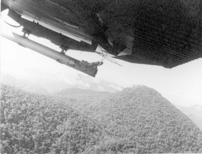
Map02 with the name "Whitehead" written next to it. The "X" marks the spot where an L-19 crashed 23 Nov 1966 in the Central Highlands northwest of Tuy Hoa carrying an observer (a Lieutenant Whitehead) and the pilot. I had met both previously but did not know either of them personnally.
Here's a picture I took the following day of the hilly jungle area where they went down.
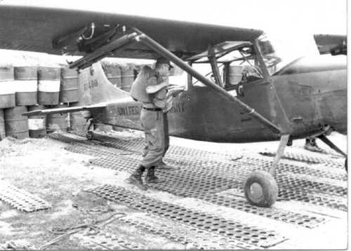
The runways were mostly dirt or PSP (pierced steel planking) strips that
were 1500 to 4000 feet long. Usually we flew in and out of Tuy
Hoa North, Song Cau or Qui Nhon, but on occasion we had to drop
off small supplies that were urgently needed at the more remote
sites. We'd return with their outgoing mail and things needing
repair. There were also jet strips (around 10,000-12,000 feet long) at
Phu Cat and Tuy Hoa South. Went we went into either of these they
were so big we could land on the aprons at either end and turn off before
ever reaching the main runway. Here's a picture I took taxiing out
at Tuy Hoa South:
The artillery postions were either 105 mm, 155 mm, 8-inch, or 175 mm
locations. A number of them were my own battery's positions over
time. I didn't tell you earlier, but I did my time over
there first as a Liaison Officer (3 months) and then (8 months)
as Commander of B Battery, 5th Battalion, 27th Artillery (105 mm) attached
to the 101st Airborne. As Liaison Officer I was expected to fly daily
to register artillery in our zone or provide fire support to guys in the
field. Later when I became Battery CO, I was called upon 2 or 3 times a
week to fly because there weren't enough qualified observers in
the zone.
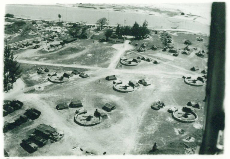
Here is a picture of my battery when it was located on a soccer field
at Song Cau in early 1967. Note the guns are laid out in a pentagon as we were
expected to fire in any direction at any time:
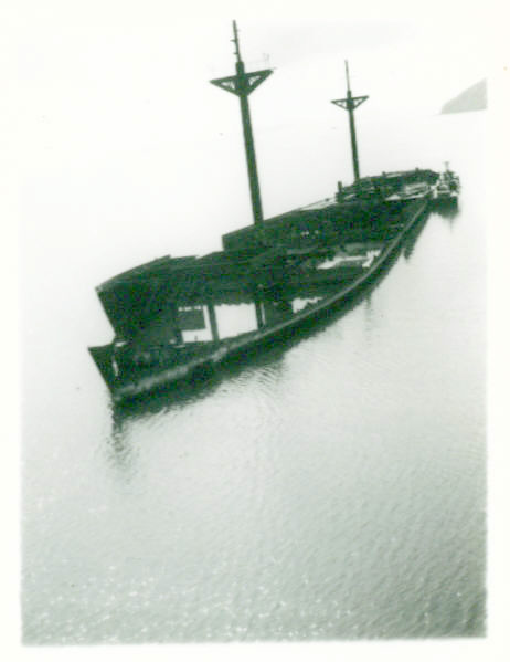
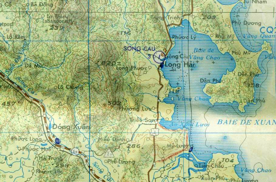
Lastly, here is one of a Japanese freighter that was sunk in
1945 by U.S. aircraft in the bay at Song Cau. The wreck is marked on
the maps that I sent. You can see the
symbol easily on the blowup of Song
Cau I sent with my original note. If you look closely you can also see a
Swift Boat (PCF-61) tied up alongside the stern. 'Swifties' used to
come into the bay on lunch breaks or to get out of the rougher, open sea during
bad weather.
Regards,
Paul
Formerly: Capt. Paul A. Marchesseault, CO, B Battery, 5th Battalion,
27th Artillery (now living in Voluntown, CT).
 Back to Map Room 3