The Map Room
Most of these maps are VERY large and take several minutes to download using a 28.8 modem. However, you will find thedetail and content of these maps worth the wait. We are working onsmaller, faster versions. Updates will be made as soon as possible, andnew maps will appear on a regular basis.
Overview of Vietnam
The City of Hue
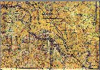
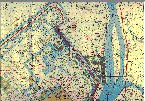 The City of Hue and immediate surrounding areasappear on two maps. The first map shows the north and west surrounding areas and most of the city itself. This First Map for the City of Hue is VERY large. However, it can be view in foursections. (Note: These are NOT quadrants of the City, but quadrants of the entire map area).
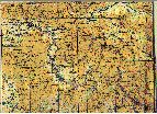
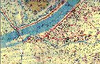 Likewise, the Second Map of Hue is large, but has again been broken into smaller quadrants:
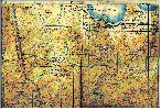
The City of Saigon and the Delta
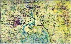 This map of the Saigon Area is not a detailed city map. It shows the outline of the city as it sits within the surrounding areas. A detailed city map will appear shortly.
The area showing the City of Saigon *from the above map* has beenbroken out for separate viewing.
Again, this map is large, and has been broken into our standard quadrant presentation. (Note: These are NOT quadrants of theCity, but quadrants of the entire map area).
Large field map of north-west Saigon area (Tan Son Nhut)
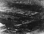 Destroyed DAO Building blown up upon the evacuation of Saigon. Just WHO Gen. Smith paid off with the missing $12Mil is STILL a mystery . [I don't see no steenking 50-gallon drums!]
 The area of river ways southeast of Saigon leadsdown to the Mekong Delta.
 And just a bit more of the lower Delta region is shown here.
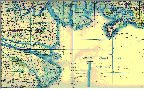
Camrahn Bay and west
 This map shows the coastal region of Camrahn Bay AND a large part of the area to the west and south. Once again, because of the size (this map is 1.8M !!), this map is presented in quadrants:
A smaller, more confined portion showing only Cam Ranh Bay can be viewed here.
City of DaNang
Several close-ups of DaNang and the airfields.
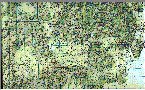
Various Areas of Operations (AO)
Presented here are map segments showing areas generally starting in ICorps and moving south. There is currently no particular order to the presentation, and unfortunately not all AO's may be shown yet.
 AO Roughly South-East of Hue
 AO Roughly North-West of Hue (Camp Evans)
 AO Roughly from
 AO Roughly Khe Sanh and south
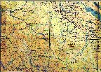
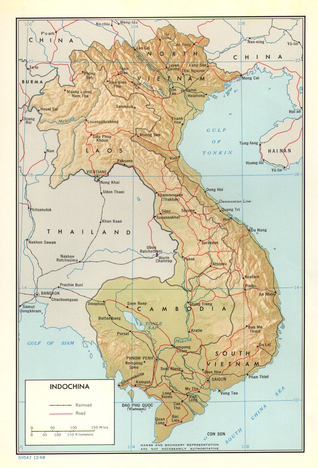 Map of Indochina
 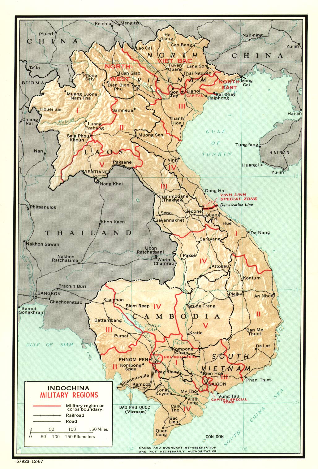 Official Designations of Military Regions for all of Indochina
 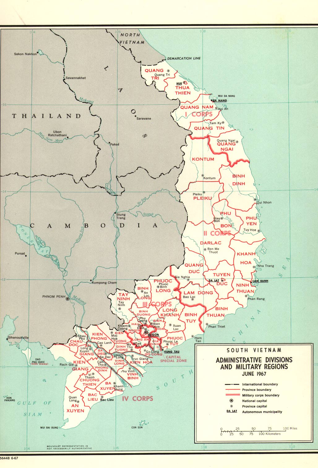 Administrative Divisions and Military Regions Detailed for South Vietnam
 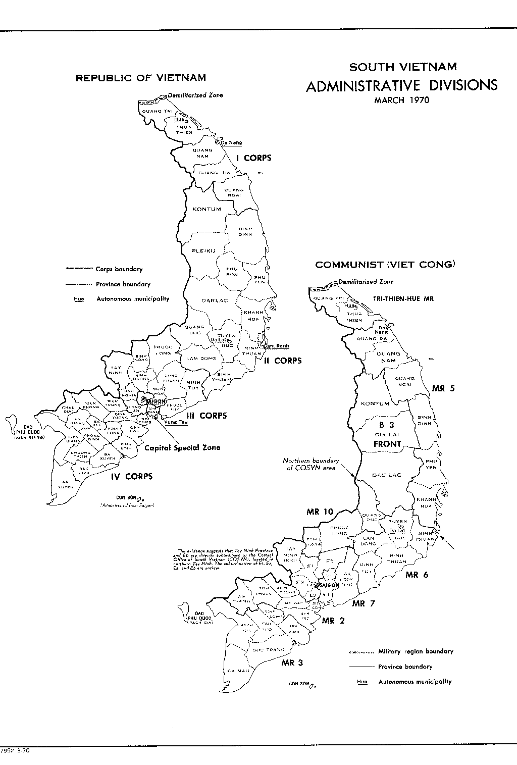 Corps and Province Boundaries for the Republic of Vietnam (South Vietnam) (black and white)
 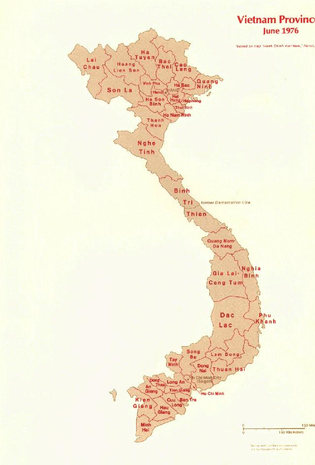 Provinces in North and South Vietnam
 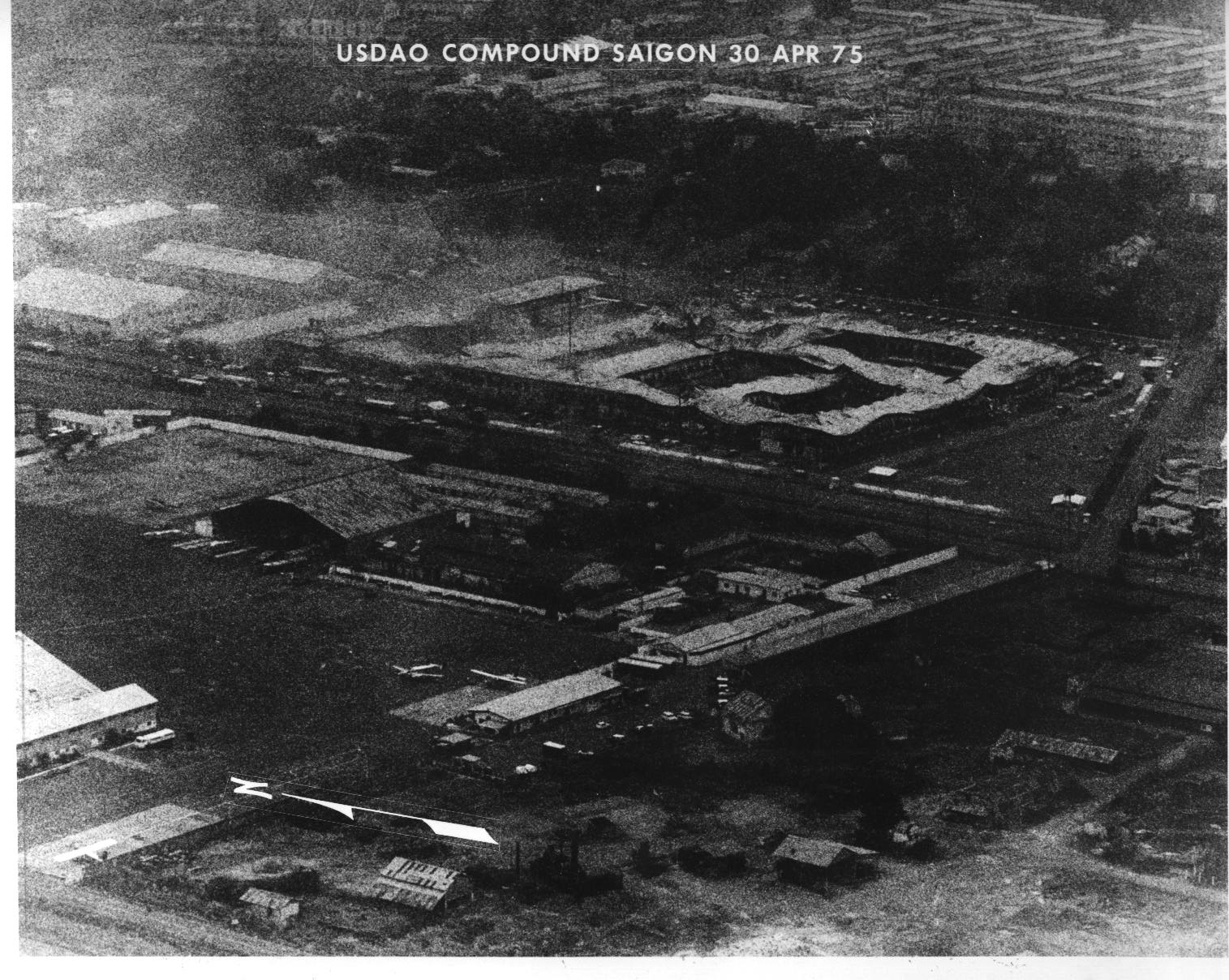 Destroyed DAO Building blown up upon the evacuation of Saigon. Just WHO Gen. Smith paid off with the missing $12Mil is STILL a mystery . [I don't see no steenking 50-gallon drums!]
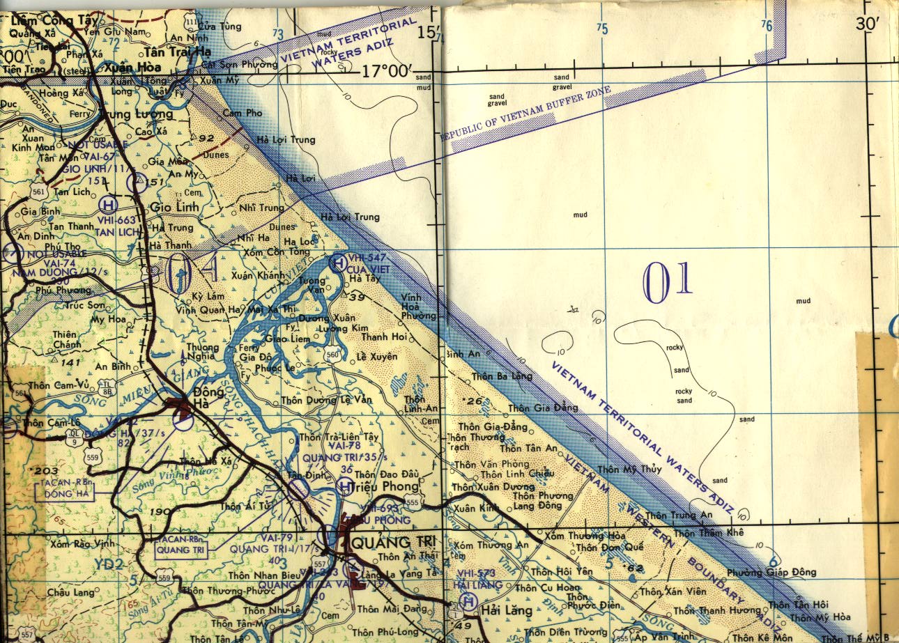 DMZ to Quang Tri
 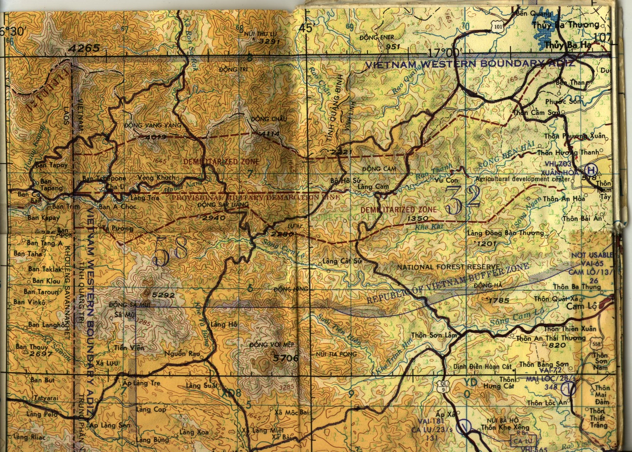 West DMZ and Cam Lo area
 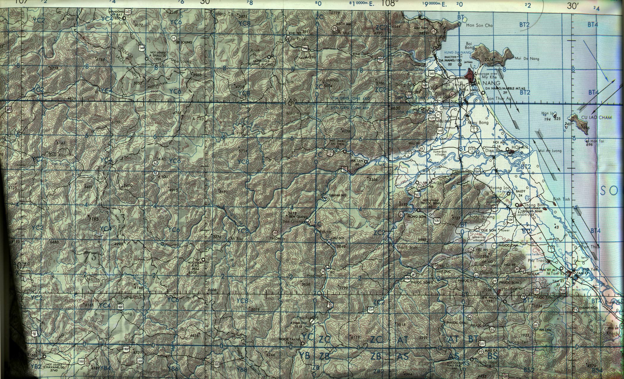 Around the Da Nang area
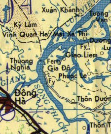 Dong Ha and Gia Do area
 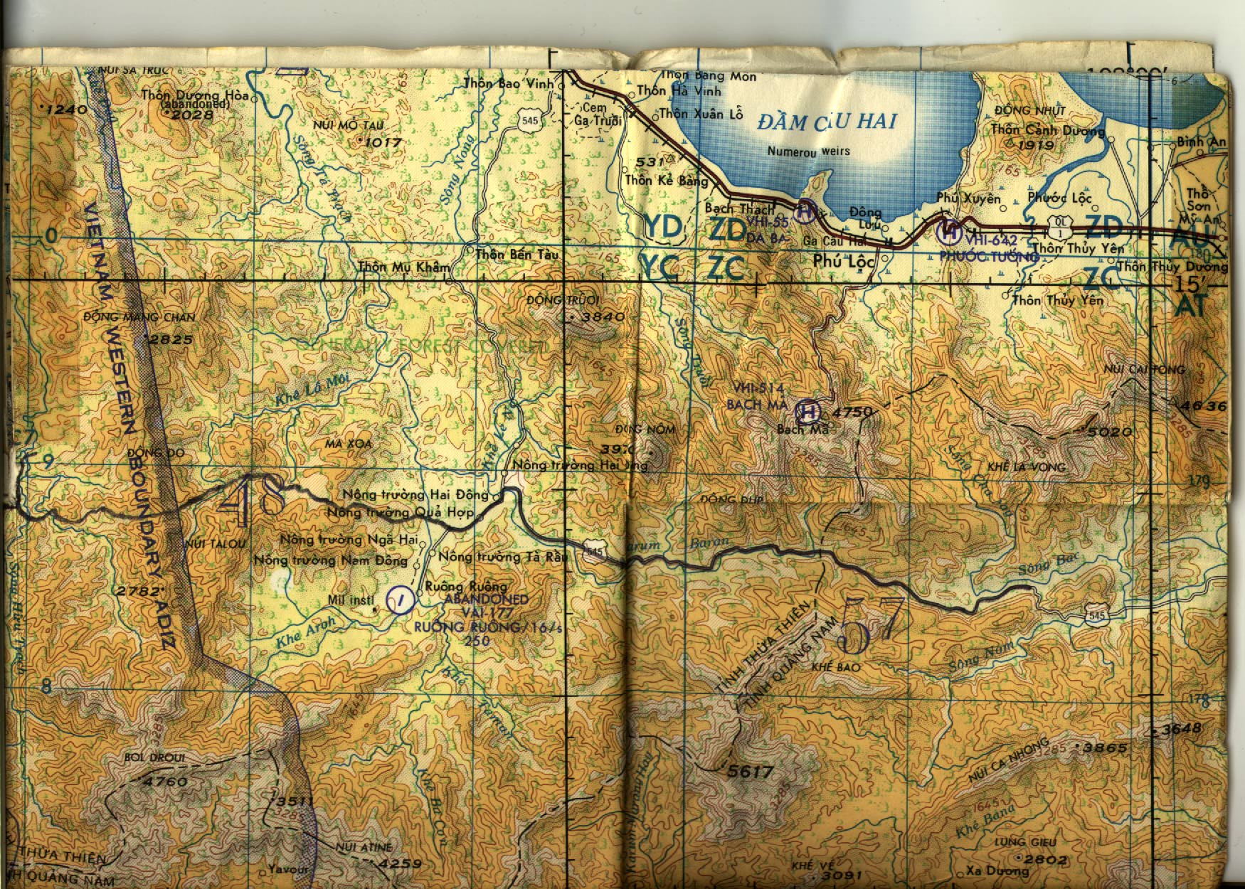 AO Roughly South-East of Hue
 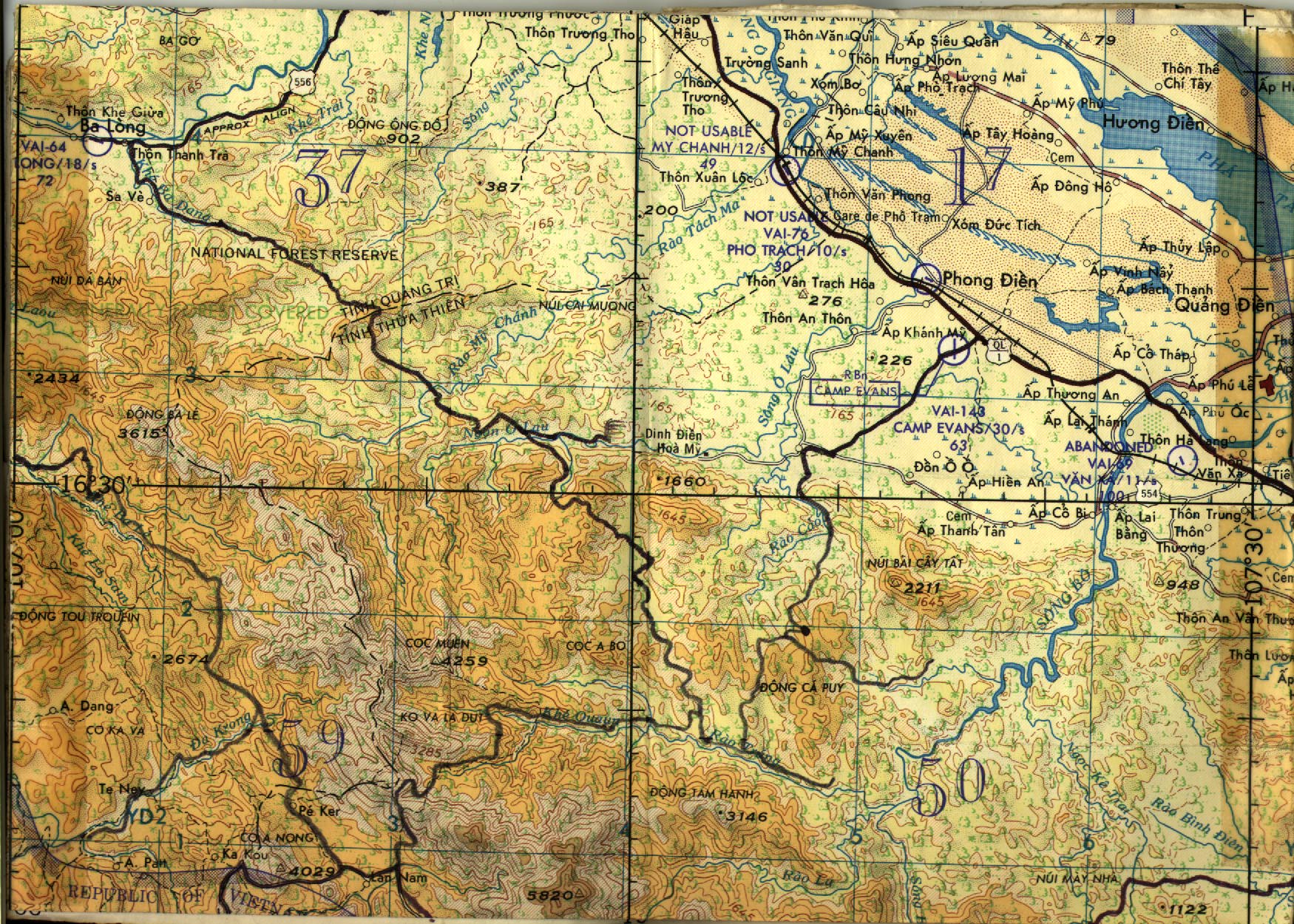 AO Roughly North-West of Hue (Camp Evans)
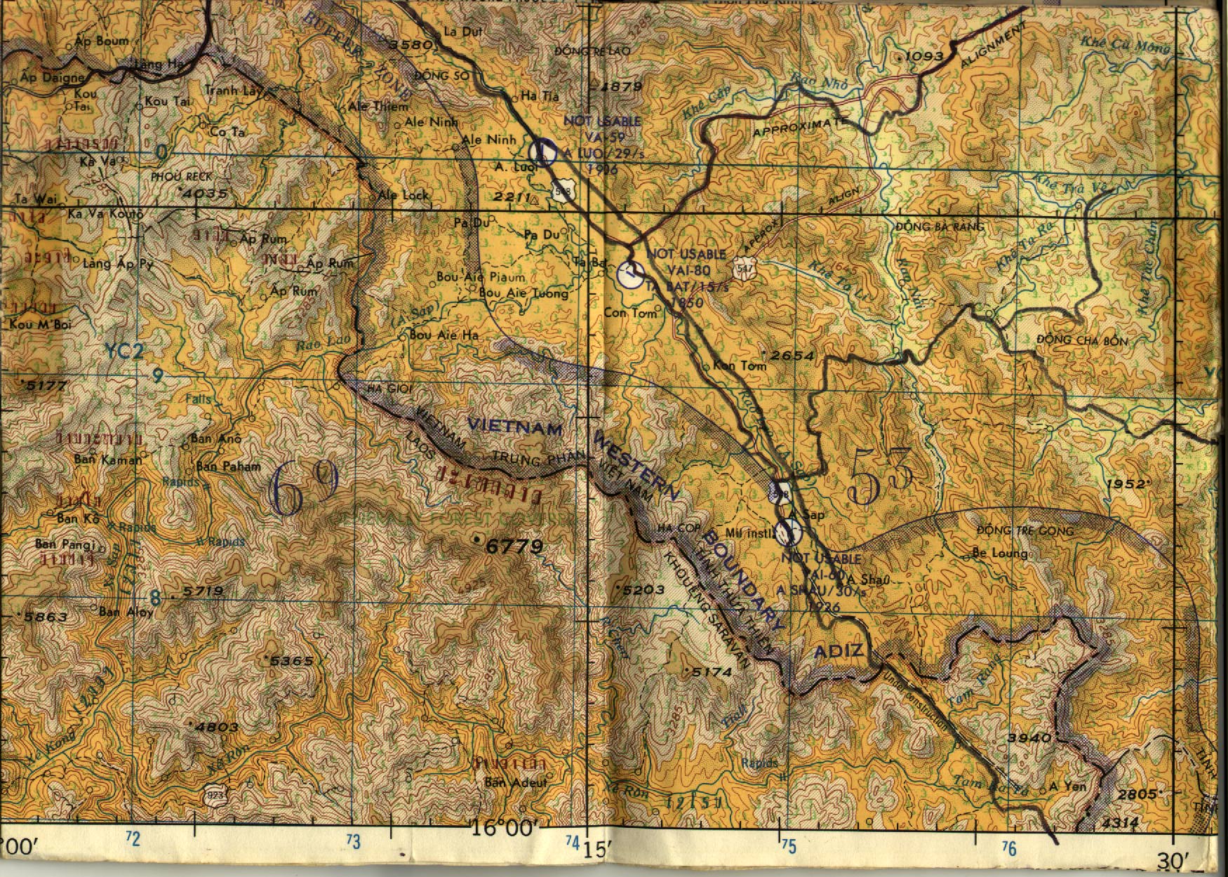 AO Roughly from
 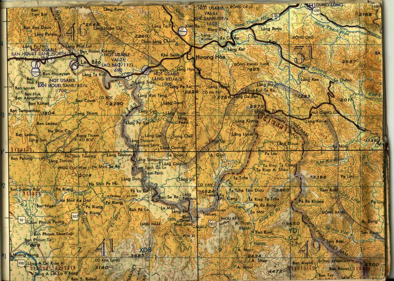 AO Roughly Khe Sanh and south
  From Nha Trang south to LongSon/Thach Long
 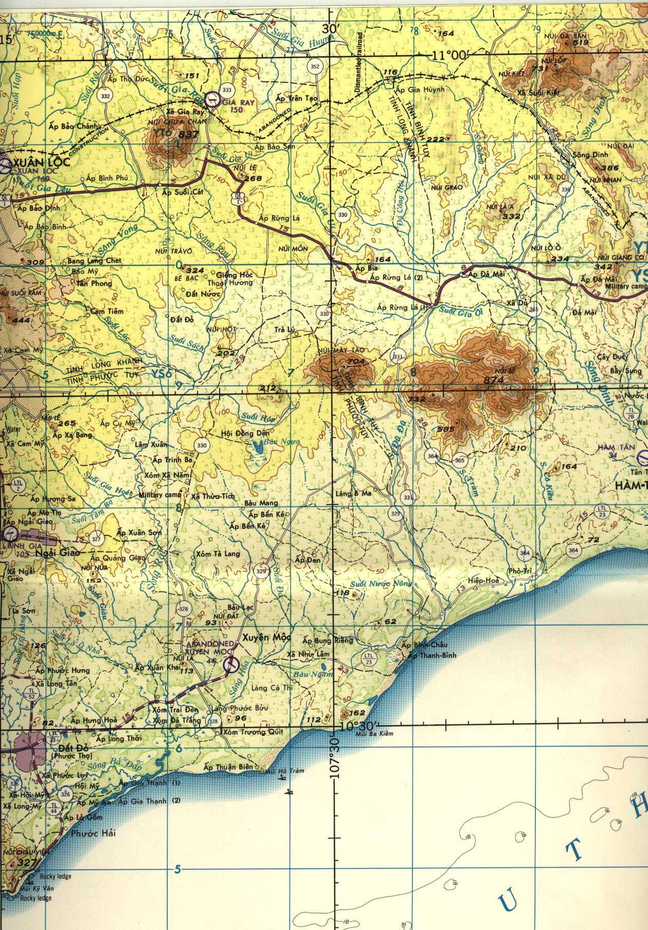 IV Corps coastal 1
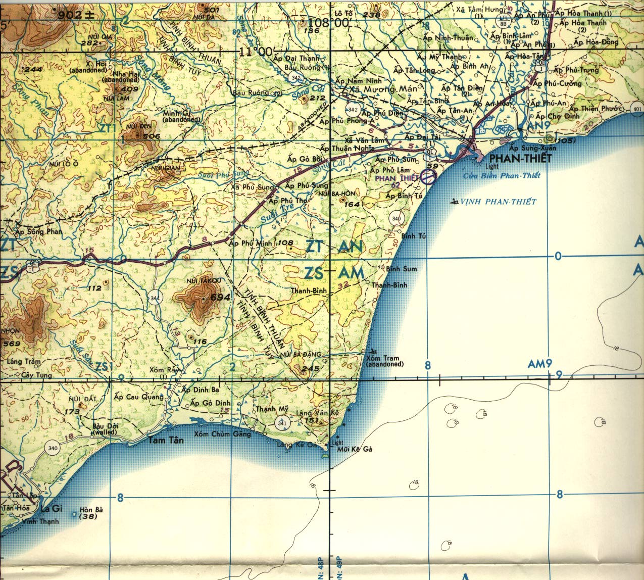 IV Corps coastal 2