 MAPS of VIETNAM
(c) Copyright 2002 Lonely Planet Publications.
All rights reserved. Used with permission.
www.lonelyplanet.com
Last Update:9 April 2013 - JPR
Map Rooms Under Construction!!!
See Last Item On Page
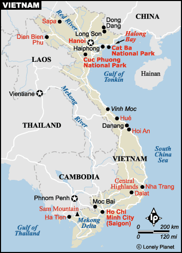
This map is a small scale map of the country of Vietnam
NOTE: If you're looking for a map scan of your old AO (Area of Operation) and if you've got the coord's or grids,
drop us a note and we'll see if we can dig something up for you!
The following maps were scanned from tactical maps. They are in compressed .jpg or .gif format. The source maps were 1:50K or 1:250K (JOG). The files are quite large and the file sizes are indicated. You may want to transfer them to your system disk before viewing. These maps were provided by Robert Edison and Dave Demsey.
"Party Line One." Area of Bill McBride's reconnaissance patrol into the A Shau Valley during August of 1967. The area is shown on 1:50,000 map provided by Dave Demsey. This .jpg file is 1.8 MBytes. You might want to download it to your disk before viewing it.
An Aeronautical Chart showing the northern I Corps area of Vietnam. Includes Hue, Quang Tri, The A Shau Valley, Khe Sahn, and a lot of the LZs and Firebases.
Satellite Imagery of the A Shau Valley in Vietnam. This was NASA imagery taken from the Space Shuttle.
Aerial Photographs of certain areas of Vietnam are linked from this page.
The following link contains a high resolution tactical map of the area around Hue. This map will be linked to the "Cakewalk" story in the Remembrance Section. The file is large and requires an external viewer. Loading time can take several minutes.
The following contains three versions of a high resolution tactical map of the area west of Nha Trang (specifically the SF A Detachment at Thon Khanh Thanh). The maps in this section will be linked to several of Sonny Hoffman's stories ("Sonny Reflections") within the Remembrance Section.
The high resolution map (1884 x 2522 pixels) was scanned from one of Sonny's orginal 1:50,000 maps, and the .gif image is quite large (almost 3 MBytes at max resolution). The JPEG version is about 1.64 MBytes, and of good quality. It will transfer faster but will take longer to decode and display, dependent upon system memory, etc.
The lower resolution version is a sub-sampled version. To view the high resolution images will require an external viewer capable of handling large .gif or .jpg image formats. Loading time can take in excess of 10 minutes.
Additional Map Rooms are being developed.
1968 Vintage Map of Vietnam provided by Richard Rooker
Notable areas in Northern I Corps from George Neville's (USMC) collection.
Ray Smith (1st Platoon, C Company, 1st Bn, 69th Armor) has an excellent Map Site with high resolution maps for almost all of I Corps, II Corps, and III Corps, and much more.
Jim Henthorn's Vietnam Vet Page has maps of the entire of Southeast Asia including THAILAND,
LAOS, CAMBODIA, SOUTH VIETNAM, and NORTH VIETNAM.
Rick Shaw has I Corps maps showing various LZs and SFBs on the USMC, 1st Radio Battalion Vietnam Veterans Map Site.
A nice map of Cambodia HERE
Purchase the USGS Vietnam Map series
Here's how to find them on the USGS web site:
Click "Enter USGS Store;"
Click on "Foreign Maps and Books" in the left Product Line margin (in the By Coverage Area Section);
Click on "Vietnam" in the long list of countries on the left;
The entire 1:50,000 scale Vietnam map set will be available to choose from.
Note: The definitive resource for finding FSB and LZ nameS and locations is Mike Kelley's book WHERE WE WERE IN VIETNAM. Information about Mike's book can be found in our PX-Bookshelf . I believe it to be the most comprehensive compilation and essentially "the last word" on where things were and what their names were. Please refer to Mike Kelley's WHERE WE WERE IN VIETNAM.
***************
Other sources for Landing Zones and Fire Support Bases include the Americal Division Home Page and The War Records site
This is a test project and may be integrated into other sections. More maps are being scanned and will show up here in the near future. Let us know what you think with some feedback to
John Paul Rossie
If you have certain areas that you would like shown here and/or if you have maps that you would like to scan or submit for scanning (all items are protected and returned), please use the E-mail contact link above and let's talk.